
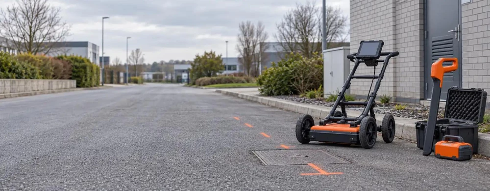
PAS 128 Surveying in Uxbridge
Get a Free Survey QuoteAt GroundSight Surveys, we provide PAS 128 surveying in Uxbridge, ensuring precise utility mapping and data collection. Our surveys determine underground utilities' locations, types and characteristics using various methods like electromagnetic detection and ground-penetrating radar.
This service is essential for construction, civil engineering and infrastructure projects, reducing risks and ensuring safety. We cover Uxbridge and the surrounding UB8 1 postcode area.
Get in touch with us today to arrange your PAS 128 survey.
What Is PAS 128 Surveying?
PAS 128 surveying defines the process for mapping underground utilities. At GroundSight Surveys, we follow these rigorous standards to deliver reliable and accurate data for our clients in Uxbridge.
Using techniques like electromagnetic location (EML) and ground-penetrating radar (GPR), our surveys identify the position and depth of utilities like gas, water, electric and telecommunications. We employ equipment such as dual-frequency GPR units for deeper penetration and multichannel GPR systems for comprehensive area coverage.
This information is crucial for planning and executing construction projects while minimising the risk of utility strikes. The process involves collecting data at different accuracy levels: Quality Level B (detection) and Quality Level C (verification) for varying depths and resolutions.
Each survey is documented following PAS 128 requirements, providing clients with detailed reports and drawings that serve as a valuable resource in project development. We invite you to contact us to ensure your next project meets its deadlines safely and efficiently.
How Much Does PAS 128 Surveying Cost in Uxbridge?
PAS 128 surveying costs from around £300 to £500 per day in Uxbridge. The price varies depending on factors such as the complexity of the site, the number of utilities involved, and the survey area size.
This type of survey involves using non-invasive geophysical methods like ground-penetrating radar and electromagnetic location to map underground utilities. Typically, we classify the surveys into four detection levels: A, B, C, and D, each offering varied accuracy based on client needs.
Level A, for instance, involves the most thorough investigations, using techniques such as vacuum excavation to verify findings, which can influence the pricing. It's especially crucial for urban environments with dense utility networks.
At GroundSight Surveys, we offer detailed quotes based on your project's specific needs, ensuring clarity and transparency. Contact us for a personalised quote on your surveying requirements.
Why Choose GroundSight Surveys for PAS 128 Surveying in Uxbridge?
GroundSight Surveys is dedicated to providing professional PAS 128 surveying services in Uxbridge. Our experienced team uses state-of-the-art equipment like ground-penetrating radar (GPR) and electromagnetic location tools, ensuring precise detection of underground utilities.
We adhere strictly to the PAS 128 standards set by the British Standards Institution (BSI), conducting robust quality checks at multiple stages. Our surveys are conducted by highly trained specialists who interpret the data to offer insights vital for engineers and project managers, aiding in minimising risks associated with construction projects.
We cater to a variety of clients, including construction firms, utility companies, and local councils, supporting projects ranging from roadworks to new building developments. Our detailed reports offer clarity on utility positions and types, enhancing the safety and efficiency of property developments.
Choose GroundSight Surveys for reliable PAS 128 data that lay the groundwork for your project’s success. Contact us to discuss your requirements in the UB8 1 area.
What Types of PAS 128 Surveys Are Available in Uxbridge?
Different PAS 128 survey types are available to meet varying project requirements, each serving a specific purpose to suit the needs of diverse clients such as construction companies, urban developers, and civil engineers.
Type D: Desktop utility record search, providing a preliminary overview of existing records and utility maps. This process is useful for understanding potential service lines without any on-site intervention and is typically completed within a few days.
Type C: Site reconnaissance with visual inspection, where surveyors conduct a walkover survey to identify visible utility clues. This step helps in planning more detailed inspections and is often the first on-site step.
Type B: Detection using geophysical techniques like Ground Penetrating Radar (GPR) and electromagnetic locators, offering a non-intrusive method to locate subsurface utilities.
Type A: Verification with physical examination, including trial holes and excavation to provide exact utility locations and conditions. This method follows health and safety standards to ensure accuracy.
We guide our clients in Uxbridge to choose the survey type that best suits their project's needs, ensuring optimal results for every phase of utility mapping.
How Does PAS 128 Surveying Work?
In PAS 128 surveying, we follow a structured process to achieve accurate results. This approach is essential for utility mapping in areas such as construction sites and urban developments.
Desktop Study: We collect and analyse existing utility records and as-built drawings to understand the potential presence and layout of services like water, gas, and electricity.
Site Reconnaissance: Our team conducts thorough visual inspections, identifying surface features and above-ground clues indicating subsurface utilities, using markings and access covers.
Detection: We employ electromagnetic location tools and Ground Penetrating Radar (GPR) to detect underground utilities. These technologies are useful for identifying the position and depth of services with high precision.
Verification: To confirm findings, we may use trial holes and vacuum excavation. This validation step ensures the reliability of the data, minimising the risk of future excavation errors.
Each step is crucial to ensure precise mapping and data quality to prevent costly errors. For optimal utility surveying, trust our methodical approach to PAS 128 compliance.
How Long Does PAS 128 Surveying Take?
Most PAS 128 surveys in Uxbridge take one to three days, depending on the survey complexity and site conditions. We use advanced methods like electromagnetic location (EML) and ground-penetrating radar (GPR) to efficiently identify underground utilities.
For sites with dense infrastructures or requiring multiple techniques, such as GPS and CAD mapping for precise documentation, the duration may extend to four to five days. Weather conditions, access restrictions, and safety protocols can also impact the timeline.
Our experienced team is proficient in interpreting complex data and meeting PAS 128 standards, ensuring accurate deliverables. Larger or more complex sites may require additional time.
Discuss your project's specifics with our team for a tailored time estimate.
What Are the Benefits of PAS 128 Surveying in Uxbridge?
PAS 128 surveying has numerous benefits for projects in Uxbridge, providing a understanding of subsurface utilities.
Improved safety: Reduces the risk of utility strikes by accurately identifying the position of pipes and cables using techniques like ground-penetrating radar (GPR).
Cost savings: Prevents costly mistakes and delays by offering detailed insights into buried infrastructure, which can eliminate unnecessary excavation work.
Informed planning: Provides accurate data for design and construction by delivering a clear utility map that informs decisions and optimises resource allocation.
Regulatory compliance: Ensures adherence to industry standards such as the New Roads and Street Works Act (NRSWA), helping avoid legal and financial penalties.
By employing PAS 128 methods, project managers, architects, and developers can enhance project efficiency. Get in touch with us to realise these benefits for your project.
Frequently Asked Questions
Is PAS 128 Surveying Mandatory in Construction?
While not legally mandatory, PAS 128 surveying is highly recommended to enhance safety and efficiency in construction projects.
What Equipment Do You Use for PAS 128 Surveying?
We use electromagnetic location tools, ground-penetrating radar and desktop research tools to map underground utilities accurately.
How Soon Can You Start a PAS 128 Survey in Uxbridge?
Scheduling depends on current workloads, but we aim to commence surveys within two weeks of enquiry for Uxbridge clients.
Can PAS 128 Surveys Be Conducted in Urban Areas?
Yes, our equipment is suitable for urban environments, allowing precise utility mapping even in congested areas.
What Is the Minimum Survey Area for PAS 128 Projects?
There is typically no minimum area, but smaller projects may incur a standard minimum charge. Contact us to discuss your needs.
Get a Free Quote for PAS 128 Surveying in Uxbridge
For reliable PAS 128 surveying in Uxbridge, reach out to GroundSight Surveys today. Ensure your project's safety and success.
We cover Uxbridge (Greater London)