
GroundSight Surveys
Contact Our SpecialistsAt GroundSight Surveys, we specialise in providing comprehensive land, building, and underground surveying services nationwide. Our expertise spans GPR, utility mapping, and topographical surveys, as well as measured building surveys.
Through the delivery of precise survey data, we empower clients to confidently plan construction, excavation, and development projects. Our commitment to accuracy ensures that your projects are based on reliable data, facilitating smooth and informed decision-making.
Contact us to get started on your next project.
Who Is GroundSight Surveys?
At GroundSight Surveys, we are expert providers of land, building, and underground surveying services across the UK. Our team uses advanced techniques like Ground Penetrating Radar (GPR) and 3D laser scanning to ensure precise survey results. GPR is particularly effective in detecting utilities and subsurface anomalies, while 3D laser scanning captures detailed measurements of buildings and landscapes.
We cater to a diverse range of clientele, including construction companies, architectural firms, and municipal agencies, helping them with utility mapping, topographical assessments, and bespoke surveying needs. By adhering to standards such as PAS 128 for utility detection and the RICS guidelines for survey accuracy, we ensure that our processes align with industry benchmarks.
Our dedication to delivering accurate data means our clients can carry out construction and development projects with greater confidence and efficiency. We invite you to contact us for your next surveying project.
What Surveying Services Does GroundSight Surveys Provide?
At GroundSight Surveys, we offer a wide array of surveying services tailored to meet diverse project needs. Our services include:
GPR Surveying: We employ Ground Penetrating Radar to detect subsurface utilities and features.
Utility Surveying: Our team provides detailed maps of underground services to aid in safe excavation planning.
Topographical Surveying: We measure and map the physical features of an area to assist with planning and design.
Measured Building Surveying: We deliver precise building measurements and layouts for redevelopment or restoration.
PAS 128 Surveying: We conduct utility surveys that comply with the recognised PAS 128 standard for accuracy.
3D Laser Scanning Surveying: Our high-resolution laser scanning provides 3D models.
Setting Out Surveying: We help translate architectural designs into physical markers on-site.
Borehole Clearance Surveying: Our clearance surveys ensure safe drilling by identifying potential underground hazards.
When Is Surveying Needed?
Surveying from GroundSight Surveys is essential for various stages of a project lifecycle. During the planning phase of construction or development projects, accurate land and utility data is crucial to avoid costly mistakes.
Our services include boundary surveys to determine legal property lines, topographic surveys for elevation data, and hydrographic surveys for assessing water bodies. We adhere to industry standards such as RICS for ensuring precision and reliability.
Our surveys are also vital when assessing existing conditions of a site for refurbishment or extension purposes. This includes identifying potential obstacles like buried utilities or structural irregularities that could impact project timelines or budgets.
For infrastructure projects, our geotechnical surveys provide data on soil composition and stability, essential for foundation design and risk management.
Whenever precise spatial data is required to make informed decisions, our surveys provide the necessary insights. Reach out to discuss how we can assist your project.
How Does GroundSight Surveys Work?
Our surveying process is structured to ensure efficiency and accuracy, adhering to industry standards such as RICS and PAS 128. It includes:
Initial Consultation: We assess your project's unique requirements and objectives, discussing site specifics, potential challenges, and any existing plans.
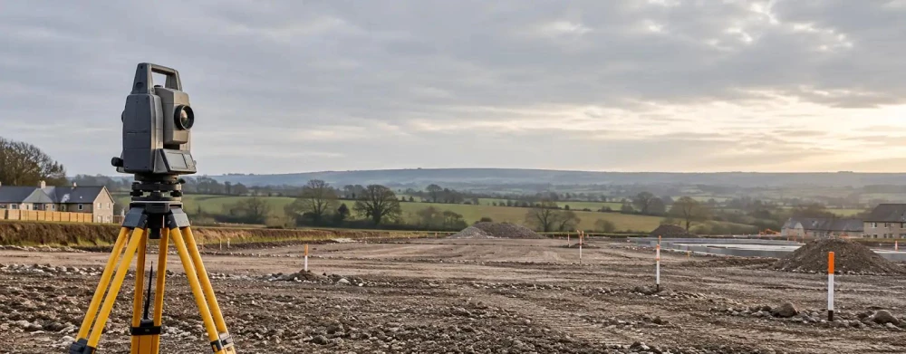
Site Survey: Our experienced surveyors employ technology like LiDAR, Total Station, and GNSS equipment. These tools help gather precise measurements and terrain data, no matter the site's complexity or size.
Data Analysis: We process and analyse the survey data through advanced software like AutoCAD and GIS, ensuring clarity and relevance for civil engineers and architects. The analysis checks for elevations, boundaries, and subsurface utilities.
Report Delivery: A report is provided, detailing all surveyed information, measurements, and implications, while recommending actionable steps for your project based on the data.
For detailed insights tailored to your project, contact us to arrange a consultation.
Who Does GroundSight Surveys Help?
At GroundSight Surveys, we support a wide array of clients including architects, engineers, construction managers, and utility companies. Our services are integral to those involved in large-scale residential, commercial, and industrial projects, as well as smaller specialised developments.
We assist property developers with pre-construction ground investigations that ensure compliance with local regulations and perform topographic surveys to provide accurate land contour data essential for effective planning.
For those involved in infrastructure projects, we offer utilities mapping services to identify underground services and avoid costly disruptions. Our geophysical surveys use electromagnetic induction and ground-penetrating radar to deliver precise subsurface data.
Moreover, hydrographic surveys for marine construction projects assist in analysing seabed conditions and sediment composition. Whether you're planning new constructions, undergoing refurbishments, or need detailed site data for other purposes, our surveys provide the necessary precision and insights.
Contact us to discuss how we can assist you with your specific project needs.
How Quickly Can GroundSight Surveys Respond?
GroundSight Surveys is committed to delivering timely and efficient responses to all survey requests. We understand that time is critical in planning construction, renovation, or maintenance projects, so we strive to accommodate schedules accordingly.
Our initial consultations help us determine project scope and allocate the appropriate resources such as 3D laser scanning or ground-penetrating radar equipment.
While the exact response time may vary based on the project scope, we typically schedule surveys within a few days to two weeks of initial contact. Once a survey is scheduled, our team swiftly mobilises using modern Total Station equipment to ensure precise data collection.
For complex projects, like large-scale commercial developments, additional preparation may be necessary to align with industry standards such as PAS 128 for utility detection.
To discuss specific timeframes for your project, please contact our team.
How Does GroundSight Surveys Ensure Quality and Compliance?
At GroundSight Surveys, ensuring compliance and quality is a top priority. Our surveying practices adhere to UK regulations, including PAS 128 and relevant industry standards.
We are committed to following the RICS guidance, which governs measurement accuracy and data handling. Our team is trained in the latest surveying techniques and technologies, such as Ground Penetrating Radar (GPR) and LiDAR, which enhance the precision and reliability of our surveys.
Regular calibration of our equipment, including total stations and GPS receivers, ensures consistency in our outputs. We meticulously follow the National Underground Assets Group (NUAG) specifications to align with current industry best practices.
Additionally, our team participates in ongoing professional development, honing skills in data analysis and interpretation to address complex site challenges.
Through these measures, we deliver surveys that meet the rigorous demands of commercial developments, public sector projects, and infrastructure maintenance plans.
Why Choose GroundSight Surveys?
Choosing GroundSight Surveys guarantees precision and reliability in all your surveying needs. We pride ourselves on using advanced Ground Penetrating Radar (GPR) and 3D laser scanning technology, offering unparalleled detail and accuracy.
Our technology allows us to conduct surveys on various surfaces and conditions, whether you need subsurface exploration or detailed building surveys. We offer our expert services across the entire UK, ensuring accessibility wherever your project is based.
Our reports are thorough and easy to understand, providing clear visual and data representations. This attention to detail helps clients make informed decisions and comply with legal and safety standards, like PAS 128 for utility detection.
With a team well-versed in industry standards such as RICS guidelines, our surveyors deliver services that meet and exceed expectations. They possess extensive experience working on diverse sites, from urban developments to rural expansions.
Connect with us to discuss how our expertise can benefit your project goals.
Frequently Asked Questions
What is GPR Surveying?
GPR Surveying uses Ground Penetrating Radar to detect subsurface features. It is valuable for locating pipes, cables, and other underground utilities accurately.
What is the PAS 128 standard?
The PAS 128 standard is a specification for the accuracy of utility surveys. It ensures that survey data meets a recognised level of quality for planning infrastructure projects.
Can GroundSight Surveys provide 3D models?
Yes, we use 3D laser scanning to create high-resolution models of surveyed sites. These models aid in detailed project planning and visualisation.
Get a Free Quote
For precise survey data you can rely on, GroundSight Surveys is here to assist. Contact us today for your free, no-obligation quote.